Jindabyne, in the NSW Snowy Mountains, sits on a lake built in the 1960s to drown the original town, whose foundations resurface when Snowy Hydro lowers water levels. Autumn (March–May) offers the clearest weather and best chance of seeing the submerged township. A day trip or overnight suits most travellers, centred on an easy, flat, free foreshore walk (45 minutes to 1.5 hours). From regional Victoria it's a 3.5–4.5 hour drive, with no practical public transport option, so a car is essential.
The Town That Vanished Underwater
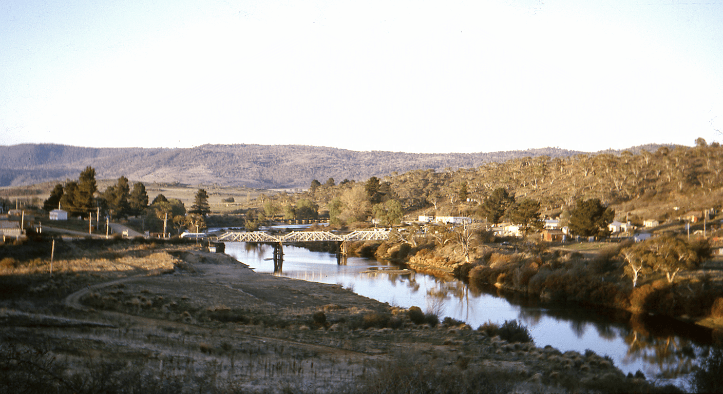
There are two Jindabynes. The one you drive into today — with its lakeside cafés, ski-hire shops and caravan parks — was built in the 1960s specifically to replace a town that was scheduled to be destroyed. When the Snowy Mountains Hydroelectric Scheme dammed the upper Snowy River, the resulting reservoir swallowed the original Jindabyne: its pub, its Anglican church, its houses, the road that once threaded through the valley. Families were relocated. Buildings that could be moved were moved. The rest went under.
What makes this more than a historical footnote is that the lake doesn't always cooperate. In years when Snowy Hydro draws the reservoir down for power generation or drought management, the old town surfaces — stone foundations emerging from the shallows, the ghost of a road visible in the mud, fence posts standing in water that was once dry land. You can't predict exactly when this will happen, but locals notice, and a quick check of recent photos on community pages or a call to the Snowy Region Visitor Centre will tell you whether the water is low enough to make it worth scanning the shoreline carefully during your walk.
Even when the lake is full and nothing shows, the knowledge of what's underneath changes how you look at the water. That reflective stillness — so photogenic on a clear autumn morning — carries a different weight once you know a whole community's geography lies beneath it. It's the kind of detail that tends to stay with you on the drive home.
Getting There From Regional Victoria
From regional Victoria, Jindabyne is a car trip — there's no practical public transport option that makes it viable as a day trip. From Wodonga, you're looking at roughly 3.5 hours via the Hume Highway and Khancoban, or around 4 hours via Corryong and the Alpine Way. From Wangaratta or Benalla, add 30–40 minutes. From Albury, the drive is closer to three hours. These are indicative times; allow more in winter when the Alpine Way and surrounding roads can be affected by ice, particularly above 1,000 metres. Always check Live Traffic NSW (livetraffic.com) before heading out.
The most scenic approach from Victoria is via the Alpine Way through Khancoban — it winds past the Snowy Scheme's Murray 1 and Murray 2 power stations, with pullout points and information boards that add context to the Jindabyne story before you even arrive. It's worth a short stop at Khancoban itself, a quiet Scheme-era town that feels like it was built for a workforce that has mostly moved on. Which, largely, it was.
If you're making it an overnight rather than a day trip — sensible for travellers coming from further afield in regional Victoria — Jindabyne has a solid range of accommodation from motel rooms to serviced apartments. Prices are seasonal and spike sharply in ski season (June–September); autumn and early summer offer the best value. Confirm current rates directly with properties or via their booking channels.
Walking the Foreshore: What to Expect
The flat path that runs around sections of Lake Jindabyne's foreshore is the centrepiece of a day here, and it costs nothing. The main accessible stretch follows the northern shore near the town centre, with sealed and compacted-gravel surfaces suitable for most walkers. It's not a challenging walk — the elevation change is minimal, the views open and consistent, and there are benches placed at sensible intervals. For a group of friends who want exercise without it becoming an expedition, it's close to ideal.
The full loop around the lake is long — around 10 kilometres — and not all of it is equally well-surfaced, so most visitors do a comfortable out-and-back along the foreshore section closest to town, which takes an easy 45 minutes to an hour and a half depending on how often you stop to look at the water. The lookout points along the way offer framing of the lake against the surrounding high country that is, on a clear day, genuinely arresting. Early morning, when the light is low and the lake is calm, is the best time.
Public toilets are available near the foreshore, and the path is largely shaded in sections by established trees. Dogs on leads are generally permitted in the foreshore area, which makes this a popular morning spot for locals — a good sign that the facilities are maintained. Confirm current access arrangements with the Snowy Region Visitor Centre, as conditions and local rules can change.
Cafés, Lunch and a Moment to Sit
Jindabyne's café scene is better than you'd expect for a town of its size, partly because it serves a ski-season clientele that demands decent coffee and partly because the population swells enough in summer to support a handful of genuinely good spots. Several cafés and restaurants are positioned along or near the main street with lake views, and the quality of food has lifted noticeably over recent years as the town has attracted year-round tourism rather than purely snow-season visitors.
A group of friends doing a day trip here will find no shortage of places to sit down for a proper lunch rather than a rushed sandwich. Look for places serving locally sourced produce — the region has good lamb, trout from the Snowy River system, and seasonal vegetables. Specific venues change their hours and menus seasonally, so it's worth a quick check on Google Maps or a call ahead, particularly if you're visiting in the quieter shoulder months when some spots reduce their days.
There's also a supermarket in town if your group prefers to bring a picnic to the foreshore — an entirely reasonable choice, and one that lets you linger at the water's edge longer than a restaurant lunch might. The foreshore has picnic tables and the setting does most of the work.
Jindabyne as the Gateway to Kosciuszko
Most people passing through Jindabyne are on their way somewhere else in Kosciuszko National Park — to Thredbo, to Charlotte Pass, to the Main Range walking trails. As a day tripper, you have the option to do the same, though it means paying the national park vehicle entry fee (around $17–$29 per day; confirm current rates at nationalparks.nsw.gov.au before you go). The drive up to Thredbo village from Jindabyne takes around 35 minutes and is itself worth doing for the alpine scenery.
For travellers who prefer to stay at lake level, the Kosciuszko context still enriches the day. The Snowy Region Visitor Centre in Jindabyne has displays on the national park's ecology, the Scheme's engineering history and the Indigenous Ngarigo people whose country this has always been. It's a thoughtful place to spend 30–40 minutes, and staff are genuinely helpful with current road and walking conditions.
One point worth noting: Kosciuszko is Australia's highest country, and even in summer the weather can shift quickly. If you're planning to drive up into the park, bring a layer regardless of how warm it is when you leave Jindabyne. In winter, snow chains may be legally required on certain roads — check Live Traffic NSW for current requirements.
Weather, Seasons and What to Pack
Jindabyne's weather is mild to cold year-round — it sits at around 920 metres above sea level, which means even midsummer evenings are cool and winters are genuinely cold, with regular frosts and occasional snow in town. The most comfortable walking weather is autumn (March–May), when the days are clear and crisp, the lake levels can be interesting, and the deciduous trees around town turn properly golden. Early summer (December to mid-January) is also pleasant, though school holiday periods bring more traffic.
Winter is not impossible as a day trip, and the town has a certain atmosphere during ski season that's worth experiencing once — the energy of a resort town doing its thing, the mountains white above the lake. But roads into the park can be icy, parking is competitive, and the cold on the foreshore is real. Layering is non-negotiable, and sensible footwear matters more than at any other time of year.
Spring (September–November) is the shoulder season — cooler than summer but often clear, with wildflowers appearing in the park from October. Snowmelt can make some park roads unpredictable in early spring. Whatever time of year, sun protection is essential at this altitude; UV levels are higher than they feel, particularly on clear days when the air temperature is deceptively cool.
Practical Details Worth Knowing
Petrol is available in Jindabyne, but prices are typically higher than in larger regional centres — fill up before you leave home or in Cooma (about 60 kilometres north, a 45-minute drive), which has more competitive pricing. Cooma is also worth a brief stop for its own Snowy Scheme heritage; the town was the administrative headquarters for the entire project and has a visitor centre dedicated to that history.
Mobile coverage in Jindabyne town itself is generally reliable with the major carriers, but it drops in and out on the Alpine Way approaches and in parts of the national park. Download offline maps before you leave. Travel insurance is always advisable for any trip, particularly for travellers with pre-existing conditions — confirm your policy covers you for regional driving and any walking activities you plan.
The foreshore walk is free and no booking is required. The national park requires a paid vehicle pass for entry beyond the park boundary. The Snowy Region Visitor Centre is free to enter. None of this requires advance planning beyond checking road conditions and café hours — which is, frankly, one of the quiet pleasures of a day trip like this. You can decide to go on a Tuesday morning and be there by lunch.
Quick planning guide
| Ideal pace | Relaxed — easy day trip or one-night stay |
|---|---|
| Best months | Autumn (March–May) for clear weather and best lake-level viewing |
| Suggested stay | Day trip, or overnight for travellers coming from further afield |
| Mobility level | Easy — flat, mostly sealed foreshore path with benches |
| Cost level | Budget-friendly — free foreshore walk; optional paid national park entry (around $17–$29/day) |
| Comfort level | Cool to cold year-round at altitude — layers and sun protection needed even in summer |
| Best for | History-curious travellers and groups wanting an easy scenic walk with a gateway into Kosciuszko |
| Main planning consideration | Car essential — no public transport option; check Live Traffic NSW for road and winter ice conditions |
Key takeaways
- The original Jindabyne township was deliberately flooded in the 1960s for the Snowy Mountains Scheme — its submerged remnants occasionally reappear when lake levels drop.
- The Lake Jindabyne foreshore walk is flat, largely paved, free to access, and takes between 45 minutes and 1.5 hours at an easy pace.
- From regional Victoria, Jindabyne is a 3.5–4.5 hour drive; a car is essential as no practical public transport covers this route.
- Autumn (March–May) offers the most comfortable walking weather and the best chance of interesting lake levels revealing the old town.
- Entering Kosciuszko National Park requires a paid vehicle pass (around $17–$29 per day; confirm current fees before visiting).
- Altitude means UV levels are deceptively high year-round — sun protection matters even on cool, clear days.
Recommended partners and links
Indicative prices only — always confirm with the operator before booking.
Frequently asked questions
Can you see the original Jindabyne township underwater?
When Snowy Hydro draws the lake down for power generation or during dry periods, foundations, road remnants and fence posts from the original township can surface near the shoreline. This is not guaranteed on any given visit — check recent lake levels with the Snowy Region Visitor Centre or local community sources before you go.
Is the Lake Jindabyne foreshore walk suitable for older or less mobile travellers?
Yes. The main foreshore section near town is largely flat, with sealed and compacted-gravel surfaces, benches at regular intervals, and public toilets nearby. It's rated Easy for mobility. The full lake loop is around 10 kilometres and not all sections are equally well-surfaced, but most visitors do a comfortable out-and-back on the town-side section.
Do you need to pay to visit Jindabyne and the lake foreshore?
The Jindabyne foreshore walk and the town itself are free to access. A vehicle entry fee applies if you drive into Kosciuszko National Park beyond the town boundary — around $17–$29 per day as an indicative figure; confirm current fees at nationalparks.nsw.gov.au before visiting.
What is the best time of year to visit Jindabyne as a day tripper?
Autumn (March–May) is generally the most comfortable for walking — clear, crisp days and the possibility of lower lake levels revealing old town remnants. Early summer (December to mid-January) is also pleasant. Winter is cold with possible road ice and high ski-season demand; spring is quieter but snowmelt can affect alpine roads.
How far is Jindabyne from regional Victoria, and how do you get there?
From Wodonga, the drive is roughly 3.5 hours; from Wangaratta or Benalla, allow around 4 hours; from Albury, closer to 3 hours. These are indicative times — add more in winter for potential ice on the Alpine Way. There is no practical public transport connecting regional Victoria to Jindabyne; a car is essential.