The Fernvale-to-Lowood section of the Brisbane Valley Rail Trail — Australia's longest rail trail — makes a comfortable day trip of five to six hours, following an 11-kilometre, near-flat gravel path through open farmland with restored timber railway bridges as its quiet highlight. Cooler months with an early start suit it best, since shade is intermittent. Mobility is easy, suited to any fitness level, and access is by car from Brisbane in under an hour, with public transport limited.
What is the Brisbane Valley Rail Trail?
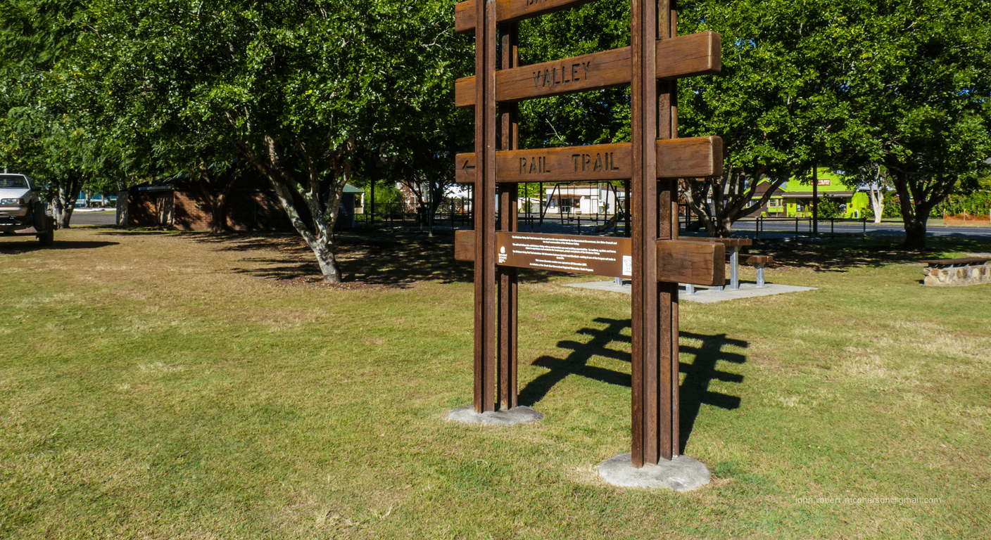
The Brisbane Valley Rail Trail runs 161 kilometres from Wulkuraka, on the outskirts of Ipswich, north-west to Yarraman in the Darling Downs. It follows the formation of the old Queensland Railways branch line — closed in 1995 — which means the gradient rarely exceeds one per cent. That's not marketing language; it's engineering reality. Railway lines were built to move freight, not to test cyclists' lungs, and that legacy makes the trail genuinely accessible for walkers of any fitness level.
The surface is compacted gravel for most of its length, with some sections sealed near townships. It passes through open farmland, patches of eucalypt woodland, small creek crossings, and the kind of unhurried South-East Queensland countryside that hasn't changed much in decades. Towns along the route — Lowood, Fernvale, Coominya, Toogoolawah — provide natural rest points, each with at least basic facilities.
For a traveller visiting from interstate — say, someone flying up from Melbourne or driving from the Gold Coast — the trail doesn't demand a grand itinerary. The Fernvale-to-Lowood section alone, roughly 11 kilometres one way, is enough for a satisfying day out without any sense of having bitten off more than you can chew.
Why the Fernvale-to-Lowood stretch works so well for walkers
Fernvale and Lowood sit either side of the Brisbane River valley, connected by this straight, quiet corridor of trail. The distance between the two town centres along the rail trail is approximately 11 kilometres, making a there-and-back walk of around 22 kilometres — perfectly manageable if you set off early and allow five to six hours including rest stops. Those who prefer a shorter outing can simply walk to a comfortable halfway point and turn around. No one is timing you.
The grade is almost imperceptible. There are no significant climbs, no technical sections, and no navigation decisions to make — the old railway formation simply leads you forward. The surface is firm enough for walking shoes, though trail shoes or light hikers with a bit of grip are more comfortable on the gravel. Trekking poles are welcome, particularly for anyone who finds them useful on uneven ground.
One honest note: this section of the trail crosses open farmland for much of its length, which means shade is intermittent rather than continuous. There are stretches of full sun, particularly in the middle kilometres. That's not a problem in the cooler months — it can be rather pleasant — but in summer it becomes the main consideration. The trail doesn't ask for fitness. It does ask for sensible timing.
Shade, water and the practicalities of a comfortable day
Shade on the Fernvale-to-Lowood section comes in patches — stands of native trees near creek crossings, the occasional remnant fig, and the vegetation that has regenerated along the old rail corridor. It's enough to offer periodic relief, but don't expect a canopy walk. The Brisbane Valley's open pastoral character is part of the appeal; it's just worth knowing what you're walking into.
Drinking water is available at both Fernvale and Lowood — the towns have public facilities — but there are no taps mid-trail on this section. Carry at least 1.5 litres per person if you're walking through, more in warmer months. A small pack with water, sunscreen, a hat, and a light snack covers everything the trail asks of you. There are no entry fees, no booking systems, no permits.
Fernvale has a well-regarded bakery and café precinct near the trailhead that serves as a natural starting and finishing point. Lowood has a small main street with cafés and a supermarket. Either town works as your base; most day-trippers park in Fernvale, walk toward Lowood, and return for a late lunch. It's a simple structure, and simple tends to work well.
Getting there from Brisbane — and from further afield
Fernvale is roughly 55 kilometres west of Brisbane's CBD, a drive of around 50 to 60 minutes via the Ipswich Motorway and the Lowood-Minden Road. Lowood is a further 12 kilometres along the Brisbane Valley Highway. The drive itself is pleasant once you're clear of the motorway — rolling green hills, the river valley opening up, the sense of genuine countryside arriving gradually.
Public transport to Fernvale is limited. Translink bus services operate to the area via Ipswich, but connections are infrequent and not well-suited to a day trip with a specific start time. Confirm current routes at translink.com.au before relying on them. For most visitors, the car is the practical choice — and the Brisbane Valley Highway is an easy, well-signed drive.
For travellers coming from interstate — from Melbourne, say — this is a day trip that slots neatly into a broader South-East Queensland visit. Fly into Brisbane, spend a night or two in the city or the Lockyer Valley, and use the rail trail as one morning of a longer stay. Fernvale has basic accommodation options including caravan parks suited to grey nomads; Ipswich, 30 kilometres east, offers a wider range.
How to pace the day — a practical framework
Leave Fernvale by 7.30 or 8.00 am, particularly between October and April. The trail faces east for part of the morning walk, so early light is with you rather than against you, and you'll cover the most exposed kilometres before the day heats up. A mid-morning break at a shaded creek crossing gives legs a rest without breaking the rhythm. Most walkers reach the midpoint — around the five or six kilometre mark — by late morning.
Turning around at that point and returning to Fernvale for a 12.30 or 1.00 pm lunch is a satisfying shape for the day. Those who want to complete the full Fernvale-to-Lowood distance can arrange a car shuttle — one vehicle left in Lowood — which removes the return walk and lets you finish at the other end. It's worth planning this before you set off rather than working it out mid-trail.
The trail is shared with cyclists, most of whom are courteous and will ring a bell or call out before passing. Walkers stick to the left; cyclists give way when overtaking. In practice, midweek foot traffic on this section is light, and weekends see a gentle increase rather than crowds. The Brisbane Valley hasn't yet attracted the volume that some better-known trails see, which is part of its appeal.
What the trail actually feels like — the honest account
There's a particular quality to walking on an old railway formation that's hard to describe until you've done it. The corridor is wider than a bush track, the surface is predictable underfoot, and the long straight lines ahead give you a clear sense of progress. You can see where you're going. For anyone who finds rugged trails anxiety-inducing — uneven roots, steep drops, unmarked junctions — this is the antidote.
The Brisbane Valley itself is understated country. Beef cattle graze in paddocks on either side, the Brisbane River occasionally comes into view through the trees, and the sky in this part of Queensland has a particular blue that Victorians tend to notice. It's not dramatic landscape. It's quiet, and the quiet is the point.
One detail worth mentioning: the old timber railway bridges along the trail have been restored or replaced, and crossing them is a small pleasure. The engineering of a century ago — designed to carry steam locomotives — is now carrying walkers across creek beds in gentle style. It's the kind of thing that makes you think about the people who built it, and the communities the line once served.
A note on the broader trail — and why doing it in pieces is the smart approach
The full 161-kilometre Brisbane Valley Rail Trail is a multi-day undertaking, typically completed over four to seven days by cyclists. As a walking trail in its entirety, it would require more than a week and a serious commitment to daily distances. For most over-50 travellers, attempting the full length on a single visit isn't the goal — and it doesn't need to be.
The trail is designed to be accessed in sections. Each town along the route is a logical starting or finishing point, and the Fernvale-to-Lowood section is consistently cited as one of the more accessible and rewarding shorter stretches. Other popular day-trip sections include Lowood to Coominya and the Toogoolawah area further north, each with their own character. Return visitors often work through the trail systematically over multiple trips — a very satisfying way to explore a region gradually.
For a couple visiting from interstate, a two-night stay in the Lockyer Valley or Ipswich region — with the Fernvale-to-Lowood walk as one day and a visit to the Ipswich Art Gallery or Lake Wivenhoe as another — makes for a well-rounded short break. The trail is the centrepiece, not the whole itinerary.
Quick planning guide
| Ideal pace | Slow and unhurried, with rest stops at your own pace |
|---|---|
| Best months | April to October, with early starts if visiting October to April |
| Suggested stay | Half a day to a full day (around 5-6 hours for the there-and-back walk) |
| Mobility level | Easy — near-flat grade suitable for any fitness level |
| Cost level | Free — no entry fees, permits or bookings |
| Comfort level | Comfortable with sensible timing, water and sun protection |
| Best for | Walkers of any fitness level, interstate visitors wanting a low-commitment day trip, and grey nomads based in Fernvale or Ipswich |
| Main planning consideration | Shade is intermittent across open farmland, so timing around heat matters more than fitness |
Key takeaways
- The Brisbane Valley Rail Trail is Australia's longest rail trail at 161 kilometres, following a former Queensland Railways line on a near-flat grade.
- The Fernvale-to-Lowood section is approximately 11 kilometres one way — a comfortable there-and-back walk for travellers who want the experience without a multi-day commitment.
- Entry is completely free; no permits, no booking, no fees at any point along the trail.
- Shade is intermittent on this section, so April-to-October visits and early morning starts are the sensible approach.
- Drinking water is available at Fernvale and Lowood but not mid-trail — carry at least 1.5 litres per person.
- The trail is accessible by car from Brisbane in under an hour; public transport connections are limited and should be confirmed before relying on them.
Recommended partners and links
Indicative prices only — always confirm with the operator before booking.
Frequently asked questions
Is the Fernvale-to-Lowood section of the Brisbane Valley Rail Trail suitable for walkers, not just cyclists?
Yes. The trail is shared by walkers and cyclists, and the Fernvale-to-Lowood section is well-suited to walking. The surface is compacted gravel, the grade is nearly flat, and the 11-kilometre one-way distance is manageable as a there-and-back day walk. You don't need a bicycle to enjoy this trail.
Is there shade along the Fernvale-to-Lowood trail section?
Shade is intermittent rather than continuous on this section. The trail passes through open farmland for much of its length, with patches of trees near creek crossings. Walkers should carry sun protection and a hat, and plan to start early — particularly between October and April when heat and humidity are factors.
Where can you get drinking water on the Fernvale-to-Lowood section?
Drinking water is available at both Fernvale and Lowood, which have public facilities. There are no taps mid-trail on this section, so carry sufficient water before you set off — at least 1.5 litres per person is a sensible minimum, more in warmer weather.
How do you get to Fernvale from Brisbane for the rail trail?
Fernvale is around 55 kilometres west of Brisbane CBD, approximately 50 to 60 minutes by car via the Ipswich Motorway and Lowood-Minden Road. Public transport to Fernvale is limited; Translink bus services operate via Ipswich but are infrequent. Confirm current routes at translink.com.au. Most day-trippers drive.
Does the Brisbane Valley Rail Trail cost anything to use?
No. The Brisbane Valley Rail Trail is free to access along its entire 161-kilometre length. There are no entry fees, permits, or booking requirements for any section, including Fernvale to Lowood.